For the first time in well over a year, I’m adding a post to this blog. Yesterday I took a quick trip to the east end of Lake Coeur d’Alene to hike a local favorite trail.

Mineral Ridge is a site managed by the BLM off of State Road 97 and above Beauty Bay. The parking lot will fill up on weekends. At the trailhead there is a picnic shelter and vault toilets. The walking stick was gift from a co-worker for my birthday twenty years ago.

Soon after starting, the trail splits and users are advised to continue in a counter clockwise direction so in other words take a right. This direction is much more enjoyable as the return down the ridge is very steep. The first mile or so climbs a gentle grade on the south side of the ridge through an area thinned in recent years for fire management.

On the way up a well marked spur trail gives access to a small hard rock mining tunnel. Apparently prospectors were convinced the ridge held a treasure hence the name Mineral Ridge.

Unfortunately for them no riches were ever found on the ridge but the small diggings they left behind make for interesting sights. The tunnel only goes in a few yards and adults can’t stand upright in it. Watch your head, the rock ceiling is very unforgiving.

At the top of the loop trail, there’s a small shelter with a view across the lake to the Blue Creek Bay I-90 bridge. A marker lets you know that your about 800 feet above the lake and the trailhead.

At the shelter you have the option of turning left to complete the loop or right to take the Wilson Road Trail to a scenic over look. I highly recommend the right. The out and back adds less than a mile to the hike and is well worth the effort. It also gets you a little higher above the lake.

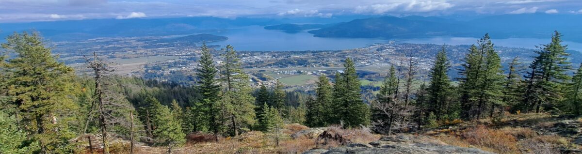
At the view point there is a bench and a nice view looking west across Lake Coeur d’Alene.

Looking east you have a view of Wolf Lodge Creek, a spot I’ve kayaked a few times. I-90 heads towards Fourth of July Pass in this small valley.

After returning to the shelter at the top of the loop trail you will continue west along a very pronounced ridge through open Ponderosa pine forest and past a couple more small prospector diggings towards a another view point.

There is also a bench here to enjoy the view of Lake Coeur d’Alene. You can just see Corbin Point on the end of Tubbs Hill from here.

To the left is Beauty Bay. State Road 97 climbs the slope on it’s way to Harrison. The BLM manages a small recreational site across the bay with a short trail to an observation deck high above the lake.

From this point, the trail descends back to the parking area on a series of steep switchbacks. Hikers cutting through the switch backs have caused significant damage to the site.

There is a nice topo map at the trail entrance. The entire hike with detours to the diggings and Wilson Road view points is only about four miles with less than 900 feet of elevation gain. This is very much a family friendly hike and a local Coeur d’Alene gem. Enjoy.
